
It's never boring in New England. After beach weather last week, we are tracking the first chance of snowflakes locally this week.
Before anyone starts digging out the snow shovels, here is what you need to know.
A coastal low will be tapping the coolest air of the season so far. That said it is still November and so even that level of chilly air is borderline when it comes to making snow (and more importantly, making it stick).
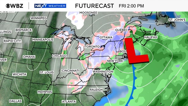
The storm will be moving across the Ohio Valley and then sliding past New Jersey and out to sea south of Nantucket Thursday night into Friday. This will bring some raw gusty breezes off the ocean and an increasing chance for a few showers on Thursday, though the overall impact will be quite low to start. Heavier precipitation will be tracking off to our northwest into New York and Vermont.
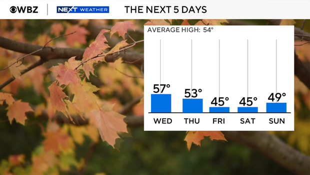
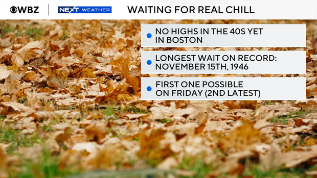
Initially, it's just chilly rain for us. We simply don't have enough cold air in place. Highs are in the 50s all week and even as the storm draws in some colder air it will lead to 40s for highs on Friday. That said, it will be the first high in the 40s all season and the second longest wait on record to achieve that benchmark.
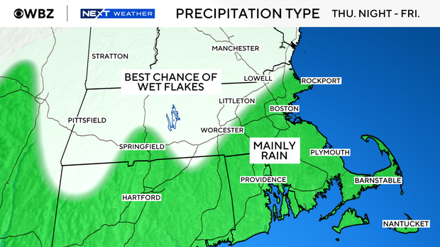
However, temperatures several thousand feet above the ground could become cold enough to support snow, especially across the higher elevations of central and western Massachusetts.
Places like the Berkshires and Worcester Hills would have a better opportunity to see minor accumulations than Boston or communities along the coast.
This is where the forecast gets interesting.
One of the biggest differences that remains is the amount of precipitation that will fall. The Euro is a little more paltry than some of its counterparts, including more meager rates that are harder to accumulate when temperatures are marginal.
The next day or so we should be able to nail down how much of that falling precipitation will come down as snow, and the amount of that falling snow which will stick and accumulate.
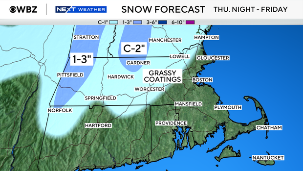
But the early call is for grassy coatings to an inch or two in the snowiest interior spots. It's not out of the question that there could be some slippery streets on Friday night in those colder interior locations, too.
Closer to Boston, along the Interstate 95 corridor and toward the coast, it will be chilly rain until later Friday when the atmosphere cools enough to bring in a chance of wet flakes. Even as that happens, nothing more than grassy coatings or conversational flakes is expected.


